Link: https://koenvandeneeckhout.medium.com/behind-the-maps-66d6377b8644
Graphic:
Excerpt:
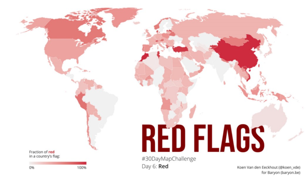
Data: I don’t know how the idea popped into my head, but I always wanted to do something with 🚩 country flags, and the color schemes they use. I had found a suitable set of all the countries’ flags in .svg format, but was struggling to extract specific colors from them. Googling around I stumbled upon the Image Color Summarizer, which partly did what I was looking for, but not entirely. I was saved when I found out that Martin Krzywinski, creator of the tool, had many other tools and examples on his mindblowing website — including an overview of all the colors in all of the different flags! 🤯 The most difficult part left to do was defining when a color was ‘red’ — #FF0000 is obviously red, but what about #D62612 (in the Bulgarian flag)? Or #FBDE4A (in the flag of Congo-Brazzaville)? This was done more or less manually by going through the entire list and quickly verifying any colours for which I had doubts.
Author(s): Koen Van den Eeckhout
Publication Date: 6 January 2021
Publication Site: Koen Van den Eeckhout