Link: https://www.nytimes.com/interactive/2021/upshot/2020-election-map.html?referringSource=articleShare
Description:
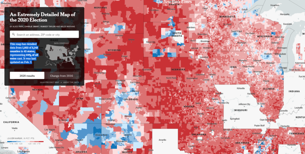
This map has detailed data from 1,922 of 3,143 counties in 42 states, representing 64% of all votes cast. It was last updated on Feb. 2.
Graph:
Authors: BY ALICE PARK, CHARLIE SMART, RUMSEY TAYLOR AND MILES WATKINS
Date Accessed: 5 February 2021
Publication Site: NY Times